It really wasn’t all that long after the Wright Brothers’ flights in Kitty Hawk air, that the 1887 Mosquito/Ponce Inlet Lighthouse was recognized as an important navigational landmark, not only for coastal water navigation, but also inevitable connections with aviation. It’s tall, very red, and has a brightly lit, powerful light on top at night! In fact, in 1911, the US Post Office Department quickly recognized the airplane as a practical means of transportation of mail, and even passengers! World War I brought many technology advances, and a large surplus of planes after the war contributed to the acceptance that planes made sense in war and peace. So did lighthouses as landmarks and skymarks, day and night, become navigational markers for planes.
Serious problems still had to be resolved if planes were to be on reliable schedules. At that time, pilots possessed little other than compasses and printed road maps. They frequently used visible landmarks on the ground to guide them. Night-flight over underpopulated sections of the country was dangerous. Bad weather added to that mix would often kill you.
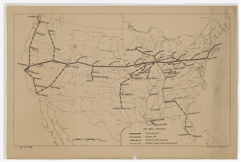
Of particular concern to the economy at that time was the speedy delivery of mail. It was critical to establish a transcontinental route which traveled from New York to Chicago to Omaha to San Francisco. Over a distance of some 2700 miles. With stops along the way, the 1920 route had 15 airfields spaced 200 miles apart. Early on, pilots flew the route in daylight, and trains carried the mail during the night.
We all know Daytona’s beach and its connection with automobiles and racing, but not many recognize that for years up to the establishment of the Daytona Beach Airport at its present location, airplanes competed with automobile traffic and sun worshipers for space on the beach. There is an excellent exhibit on the hard-packed sand of Daytona serving early local aviation, airplanes, and their hangers on the beach in the Principal Keeper’s Residence at the Ponce De Leon Inlet Lighthouse.